On this page
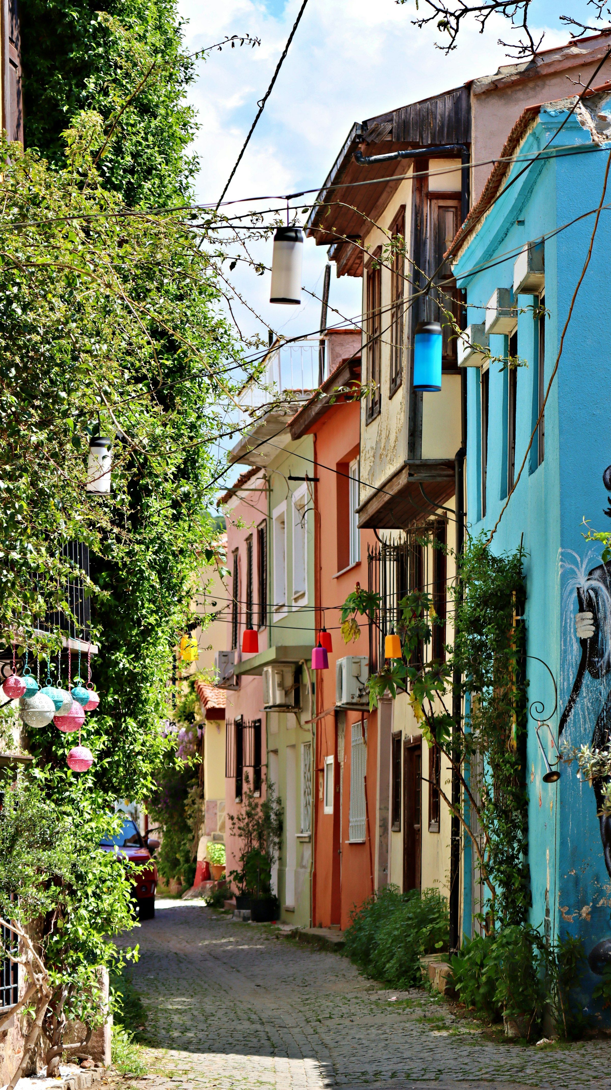
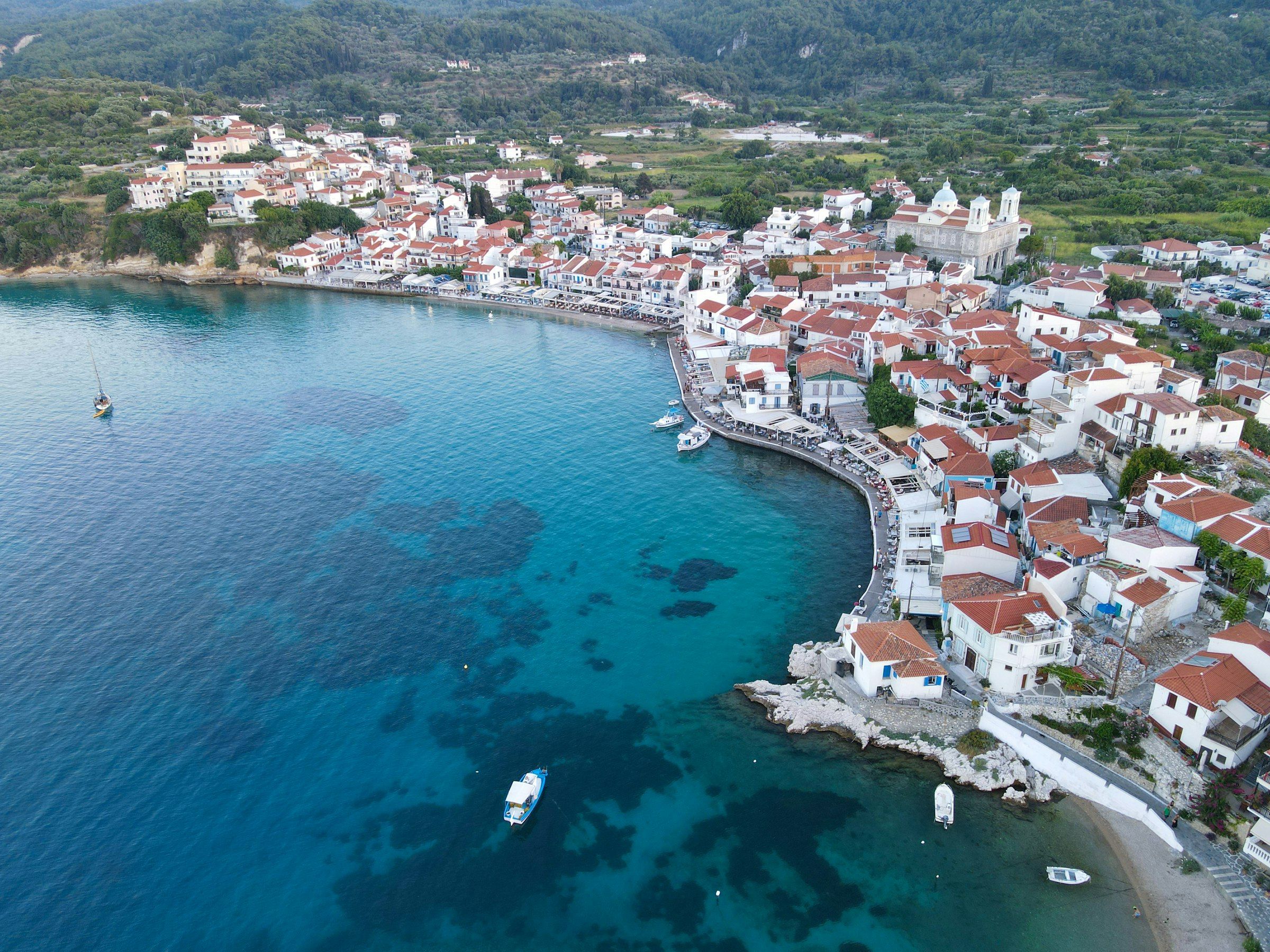
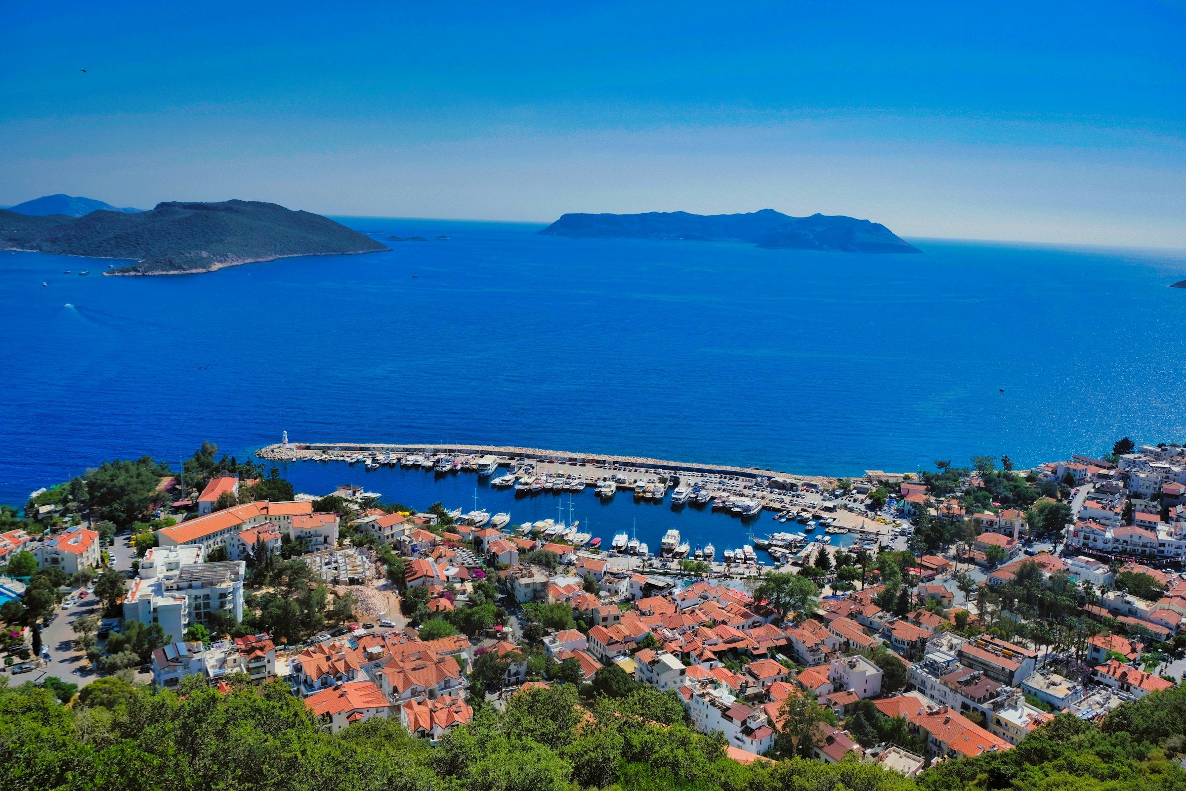
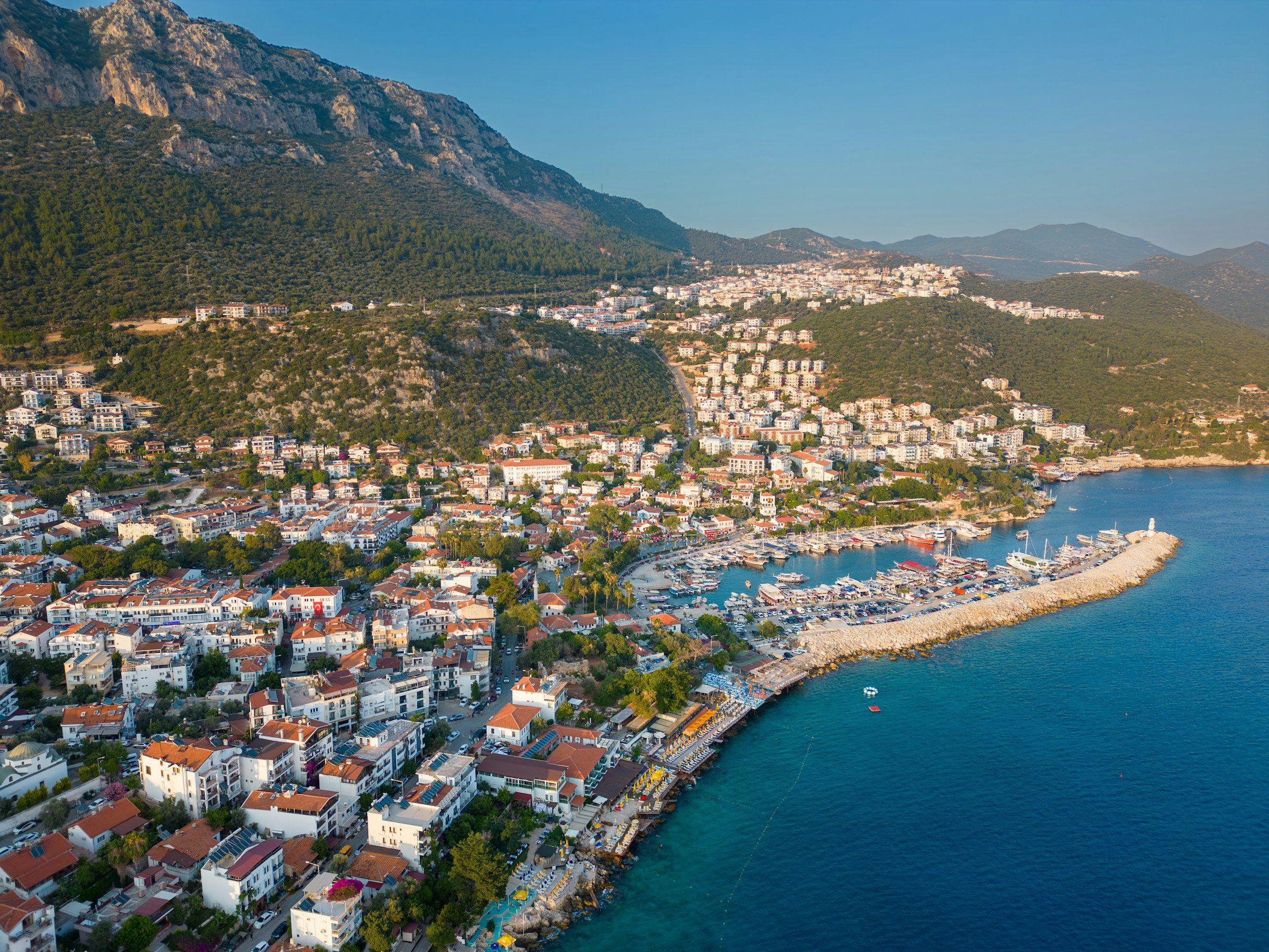
Kaş is a small harbour town on the far western edge of Antalya province, built over the ancient Lycian city of Antiphellos. Lycian tombs stand in its lanes, a Hellenistic theatre sits just outside the centre, and the Greek island of Kastellorizo (Meis in Turkish) lies about 2 km offshore. Small passenger ferries leave from the harbour in the middle of town, which makes Kaş one of the easiest places on the coast to add a Greek island to a Turkish holiday.
Short answer
- Where to stay: The harbour and Uzun Çarşı (Long Bazaar) area is the most practical base if you want to walk everywhere and catch a morning ferry. See where to stay in Kaş for options.
- Top three sights: the Antiphellos theatre, the Lion Tomb (King’s Tomb) at the top of Uzun Çarşı, and a boat trip to Kekova.
- Getting to the ferry: Kastellorizo ferries leave from Kaş harbour in the town centre. Both operators’ ticket offices are in the old town, opposite and just behind the harbour.
- How many days: Three days covers the town, a beach day and Kekova. Allow four or five if you want a day on Kastellorizo plus Patara or Saklıkent.
- Best months: spring and autumn for walking and sightseeing, summer for swimming and boat trips. The ferry runs all year, but on fewer days in spring and autumn.
Things to do
Antiphellos theatre
The Hellenistic theatre on the hillside just outside the centre is the first thing to see in Kaş. Its seating and orchestra are well preserved. According to the Ancient Theatre Archive it held about 4,000 spectators, and the seating faces south-west over the sea towards Kastellorizo, which is why it fills up at sunset. Sources disagree on its date, placing it somewhere between the 2nd and 1st centuries BC, with later Roman changes.
The Lion Tomb (King’s Tomb) and Uzun Çarşı
At the top of Uzun Çarşı, the lane that climbs from the harbour through the middle of town, stands the Lion Tomb, often called the King’s Tomb locally. This 4th-century BC Lycian sarcophagus has a pointed lid with two lion heads. A nine-line inscription on its north face is written in Lycian B, a rare form of the Lycian language that has never been fully deciphered; its first line names Pixre, thought to be the man who commissioned the tomb. It stands in the street, so you will pass it simply by walking up the bazaar.
Lycian rock tombs
The tombs of Antiphellos are scattered all over town: sarcophagi in the lanes, and tombs cut into the cliffs above. Turkey’s cultural inventory lists a Doric-style rock tomb and a rock-tomb necropolis among the monuments of the ancient city. Remains of the acropolis walls overlook Kastellorizo, and traces of the old sea walls survive in places.
Limanağzı
Limanağzı is a cove on the far side of Kaş bay with no road access, inside a protected natural area. Boats from Kaş harbour take about 15 minutes. A few beach businesses operate there. The Lycian Way also runs from Kaş to Limanağzı, so you can walk there along the trail and take the boat back.
Büyükçakıl and Küçükçakıl
These are the swimming spots closest to town. Büyükçakıl is about 1.5 km from the centre and most people walk there; a row of beach businesses lines the shore. Küçükçakıl is closer still, with beach clubs on wooden platforms nearby. Either works well for a half day before or after the ferry.
Kaputaş beach
Kaputaş sits where Kaputaş Canyon meets the sea, beside the D400 coast road between Kaş and Kalkan, about 19 to 20 km from Kaş and about 7 km from Kalkan. You reach the beach down a 187-step staircase from the road, and climb the same stairs back. The beach is a mix of sand and fine pebbles, and underground springs keep the water cool even in summer. Minibuses on the Kaş–Kalkan route stop there.
Kekova: the Sunken City and Simena (Kaleköy)
Kekova is an island and a group of surrounding coves in neighbouring Demre district, protected since 1990 as a Special Environmental Protection Area and archaeological site. Along the island’s shore lies the Sunken City, the remains of ancient Dolichiste, partly submerged by earthquakes; from a boat you can make out staircases and wall foundations. Swimming and diving over the ruins are banned, so boats pass slowly over them. Opposite is Simena, today’s Kaleköy, a village reachable only by sea. You can climb to its castle, and a Lycian sarcophagus standing in the water off the shore is one of the best-known sights in the area.
From Kaş you can either join a boat tour from Kaş harbour or drive to Üçağız and board a boat there. Some tours sold in Kaş transfer guests by road to Üçağız and start the boat trip from there, so ask when you book.
Diving
Kaş is one of Turkey’s best-known diving centres. A 2020 news report counted about 35 dive sites and 22 dive schools in the district, around 80,000 dives a year, and diving possible in all twelve months. Named sites include the Canyon, Uçanbalık bank, Kovanlı Island, the Tunnel and Limanağzı, and the wrecks include a C-47 aircraft, a tank and an Ottoman-era wreck.
The Lycian Way
Turkey’s best-known long-distance walking route runs between Fethiye and Antalya and passes through Kaş. Its total length is given as anything from 540 km to 760 km, because the route has been extended over time. East of Kaş, the trail runs past Limanağzı and close to Boğazcık and ancient Aperlae, on to Kılıçlı and then Üçağız. If you do not want a multi-day walk, you can hike only from Kaş to Limanağzı and return by boat. The route’s own site recommends February to May and September to November, and calls summer too hot for long walks.
Patara
Patara lies in Kaş district, on the coast beyond Kalkan next to the village of Gelemiş, and was the capital of the Lycian League. Its remains include the council building where the League met, a theatre that seated more than 5,000, and a lighthouse built under Nero, counted among the oldest surviving ancient lighthouses. The long sandy beach next to the ruins is a nesting ground for loggerhead turtles. Patara is on UNESCO’s tentative list as part of the Ancient Cities of Lycian Civilization, and Akdeniz University has excavated the site since 1988.
Saklıkent Canyon
Saklıkent National Park sits on the border between Kaş district and Muğla province and was declared a national park in 1996. The canyon is given as 16 to 18 km long; visitors use the wooden walkway at the entrance, and the water inside is very cold. One news report puts it about 63 km from Kaş.
Getting to the ferry port
Two companies run the Kaş–Kastellorizo route: Meis Express and Meis Ferry Lines. Ferries leave from Kaş harbour in the town centre and arrive at Kastellorizo’s main harbour on the north-east of the island. The two ports are about one nautical mile apart; sources give a crossing time of roughly 20 to 30 minutes, depending on the boat and sea conditions. For timetables, fares and entry rules, see the Kaş to Kastellorizo ferry guide.
- From the centre: The harbour is in the middle of town. From the Uzun Çarşı and main square area it is a few minutes’ walk. If you are staying further out, for example on the Çukurbağ peninsula, you will need a taxi or your own car.
- Tickets: Both companies’ ticket offices are in the old town, opposite and just behind the harbour. Meis Express also sells tickets online. If you have not booked online, you can buy at the office the day before; you will be asked for your passport details.
- Passport control: This takes place in Kaş on the morning of travel and again on Kastellorizo after you land. The boats are small, so queues are usually short.
- How early to arrive: The Meis Express website does not state a check-in time. A ferry information site advises being at the port at least an hour before departure for passport and exit formalities; confirm the exact time with the office that sold your ticket.
- Parking: As far as could be verified, the harbour has no large passenger car park of its own. A ferry information site says there are paid municipal car parks and private car parks around the marina. If you are leaving a car for several days, ask the ticket office where to park. This route is passenger-only; for routes that take cars, see taking a car to the Greek islands.
To see every Turkey–Greece crossing on one page, use the ferry map.

Getting there
By air: Dalaman is the nearest airport to Kaş. Published figures for the distance range from about 150 km to 180 km, and the drive takes roughly 2 to 2.5 hours. Antalya Airport is further: a transfer company gives about 185 to 200 km and 2.5 to 3 hours. Antalya city centre is about 190 km away. From either airport you can hire a car or book a private transfer. From Dalaman, Havaş shuttles run to Fethiye, where you can continue to Kaş by bus or minibus.
By bus: Kaş has its own bus station, with direct services from Turkey’s large cities. Buses and minibuses run daily from Antalya bus station; the trip takes about 4 hours. Fethiye to Kaş is about 110 km along the coast.
By car: From Antalya you can take the coast road via Kemer or the inland route over the Taurus mountains. From the Fethiye side, the D400 passes Kalkan and Kaputaş on the way into Kaş. For overall budgeting, see the trip cost page.
A day before or after the crossing
If you are catching a morning ferry to Kastellorizo, spending the previous day in town lets you sightsee at an easy pace and sort out tickets and passport details in advance.
- Morning: Start at the harbour and walk up Uzun Çarşı to the Lion Tomb. On the way back, stop at the ticket office to collect your ticket and confirm the departure time.
- Afternoon: Walk to Büyükçakıl, or take a boat across to Limanağzı for a few hours of swimming. For a longer outing, take the minibus to Kaputaş and allow for the 187 steps.
- Evening: Climb to the Antiphellos theatre for sunset, with Kastellorizo directly ahead.
The same plan works on the day you return from the island. If you would rather spend that morning on a Kekova trip, check in advance whether it leaves from Kaş or from Üçağız.
When to go
- Summer (June to August): the best time for swimming and boat trips, but also when Kaputaş and Limanağzı are busiest. Evening ferry crossings are sometimes added in high season.
- Spring and autumn: the best time for the Lycian Way; the route’s site recommends February to May and September to November. The ferry still runs, but on fewer days a week. A board outside the ticket office lists the sailing days.
- Winter: the town is quiet. Diving is possible all year. Ferry booking sites list the route from January to December, but winter sailings are infrequent.
To check which routes run in which months, see the ferry season calendar.
FAQ
How long is the ferry from Kaş to Kastellorizo?
Sources give roughly 20 to 30 minutes, depending on the boat and sea conditions. The two harbours are about one nautical mile apart.
Where does the Kastellorizo ferry leave from in Kaş?
From Kaş harbour in the town centre. The Meis Express and Meis Ferry Lines ticket offices are in the old town, opposite and just behind the harbour.
Is there parking at Kaş ferry port?
The harbour has no large passenger car park of its own. Paid municipal and private car parks are reported around the marina. Ask the ticket office where to leave a car for the length of your island stay.
Can you swim over the Kekova Sunken City?
No. The ruins are protected, and swimming and diving over them are banned. Boats pass slowly over the site, and tours stop for swimming in other coves nearby.
Which airport is closest to Kaş?
Dalaman Airport, roughly 150 to 180 km away depending on the source. Antalya Airport is a little further but has many more flights.
How many days do you need in Kaş?
Three days is enough for the town, a beach day and a Kekova trip. Plan four or five if you also want a day on Kastellorizo and a visit to Patara or Saklıkent.
Opening hours and prices change; check the official source before you go.
Sources
- Kültür Envanteri: Antiphellos (accessed Oct 2026)
- Ancient Theatre Archive: Antiphellos (accessed Oct 2026)
- Medgulets: Kaş Lion’s Sarcophagus (accessed Oct 2026)
- Küre Ansiklopedi: Kaputaş Beach (accessed Oct 2026)
- Küre Ansiklopedi: Kekova (accessed Oct 2026)
- CNN Türk: Kekova (accessed Oct 2026)
- Küre Ansiklopedi: Saklıkent National Park (accessed Oct 2026)
- CNN Türk: Saklıkent Canyon (accessed Oct 2026)
- Enuygun: Kaş beaches (accessed Oct 2026)
- Yeni Akit: diving tourism in Kaş (2020) (accessed Oct 2026)
- Culture Routes in Turkey: The Lycian Way (accessed Oct 2026)
- Yabangee: Lycian Way from Kaş to Üçağız (accessed Oct 2026)
- UNESCO Tentative List: Ancient Cities of Lycian Civilization (accessed Oct 2026)
- Turkish Museums: Patara (accessed Oct 2026)
- Akdeniz University: Patara excavations (accessed Oct 2026)
- Turkey’s For Life: Kaş to Kastellorizo ferry (2026) (accessed Oct 2026)
- Ferryhopper: Kaş to Kastellorizo (accessed Oct 2026)
- Meis Express (accessed Oct 2026)
- Feribot Seferleri: Kaş port (accessed Oct 2026)
- Turna: how to get to Kaş (accessed Oct 2026)
- Yolcu360: Kaş (accessed Oct 2026)
- Ulaşım Transfer: closest airport to Kaş (accessed Oct 2026)